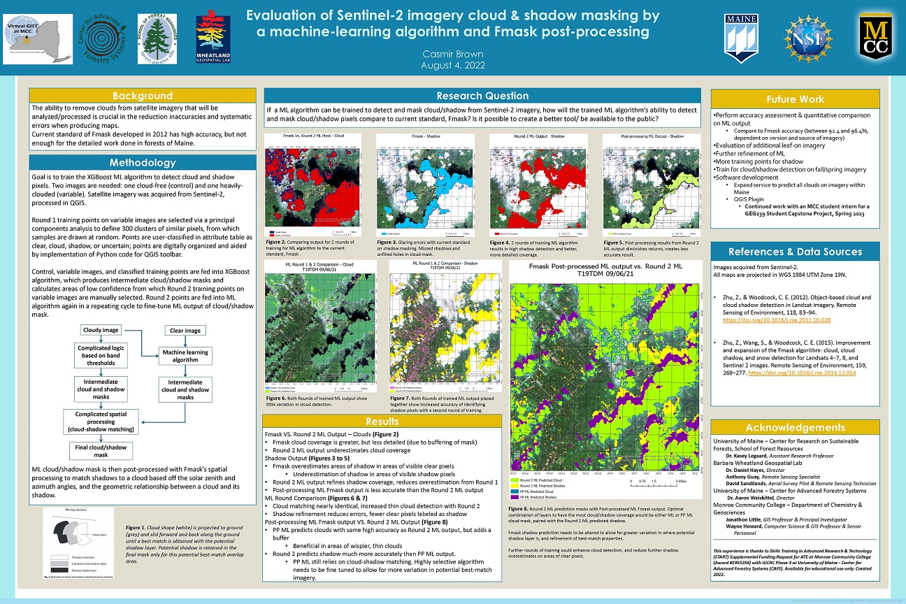
UMaine CAFS Hosts GIS Community College Internship Experience
![]() Casmir Brown and Bryon Carroll, students of Jonathon Little, Associate Professor of Geography at SUNY-Monroe Community College (MCC), arrived in Orono over the summer for an 8-week internship focused on geographic information systems (GIS) and forestry-related fieldwork.
Casmir Brown and Bryon Carroll, students of Jonathon Little, Associate Professor of Geography at SUNY-Monroe Community College (MCC), arrived in Orono over the summer for an 8-week internship focused on geographic information systems (GIS) and forestry-related fieldwork.
Casmir began his studies in graphic design a few years ago, but found courses in that topic too restrictive for his artistic interests. After working for several years, he enrolled in geography classes at MCC, in particular Little’s GIS course, and found it both interesting and engaged his creativity. Byron’s initial coursework started in bioengineering, but he recognized quickly that was not the right fit for him, so he decided to re-focus on the biology side of things. He enrolled in the GIS course to add skills he thought would be helpful in that major.
Until they arrived in Maine, both students had never done fieldwork related to their GIS studies. While Byron has a background of exploring the outdoors in the Adirondacks region, Casmir has been more urban-based for most of his life. Both found their training in the Barbara Wheatland Geospatial Lab and forest experiences throughout Maine have greatly expanded their understanding of GIS, forest management, and environmental sciences.
The internship opportunity came about quickly. Partnering with UMaine’s Dr. Aaron Weiskittel, Director of NSF’s IUCRC Center for Advanced Forestry Systems (CAFS), Little successfully applied for supplementary funding from NSF’s Skills Training in Advanced Research & Technology (START) program for a paid internship for the students to collect and process field data for remote sensing applications. “Remote sensing and forest health are a logical fit for CAFS, with its mission to create a future with sustainable, healthy forests and to promote workforce development—GIS skills are particularly valuable to CAFS industry members,” said Weiskittel.
Little thought his students were excellent candidates for the program: “Casmir and Bryon made a great team, worked hard, and took full advantage of the excellent learning opportunities given to them by researchers from UMaine, UM Fort Kent, and Acadia’s Schoodic Institute.”
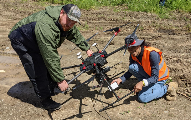
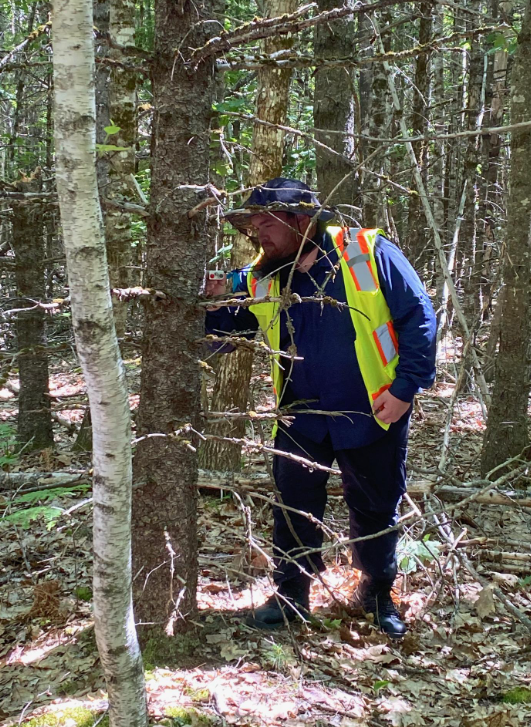
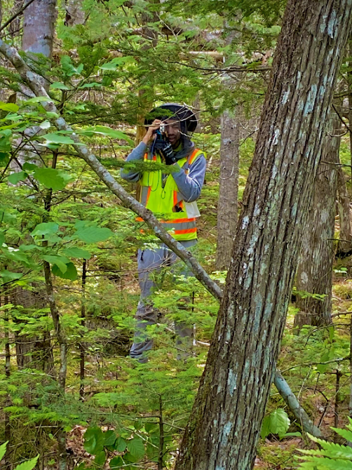
Upon arrival, the students immediately engaged in the work at Wheatland Lab with UMaine researchers Dan Hayes, Tony Guay, Dave Sandilands, and Kasey Legaard. Under their mentorship, Bryon and Casmir worked with machine-learning software and artificial intelligence to create cloud-free satellite imagery; the end goal being automated calculation of tree biomass. They worked with LiDAR data to produce 3D maps and predictions, and gained first-hand knowledge of how drones are used for data collection.
“The field experiences were amazing—there just was not enough time in any particular spot,” offered Bryon. The field excursions included collecting tree data at continuous forestry inventory plots at the Penobscot Experimental Forest; spending time in Fort Kent and sites around northern Maine to study tree morphology, leaf data, and tree regeneration, as well as measuring C02 uptake and release of water vapor from plant samples; and working with the Town of Orono to classify trees in poor health or impacted by pests/insects, and those with the potential to interfere with power lines. The students also had the opportunity to spend two days on the coast, where the goal was to identify plant species at regeneration plots on the summit of Acadia’s Cadillac Mountain—and to enjoy fresh seafood.
The summer work has reinforced Bryon’s plans to move forward with his goal to major in wildlife science at Paul Smith’s College, with a minor in GIS: “Through what I have experienced here, I can see how it will apply to my career goals. It has opened my eyes that GIS is integrated in everything, so valuable for forest management or natural environmental science.”
“For me, it has reaffirmed that I want to go into data collection. When I am working in GIS and making maps that are visually appealing, it is important to have the data stand out. There’s intelligence to the art you are creating,” added Casmir, who will be transferring to Arizona State University to complete his undergraduate degree in GIS.
Learn more about the MCC GIS internship to Maine:
Capstone presentation (video recording): MCC GIS internship and cloud masking research video presentation
MCC GIS Summer Internship story maps by Casmir Brown and Bryon Carroll: Weeks 1-4, Weeks 5-8
 Internship funded by a 2022 NSF Skills Training in Advanced Research & Technology (START) Supplemental Funding Request for ATE at Monroe Community College (Award #1955256) with IUCRC Phase 3 at University of Maine – Center for Advanced Forestry Systems (CAFS).