NASA Awards Funding for a Carbon Monitoring Framework in Forestry Decision-Making to UMaine
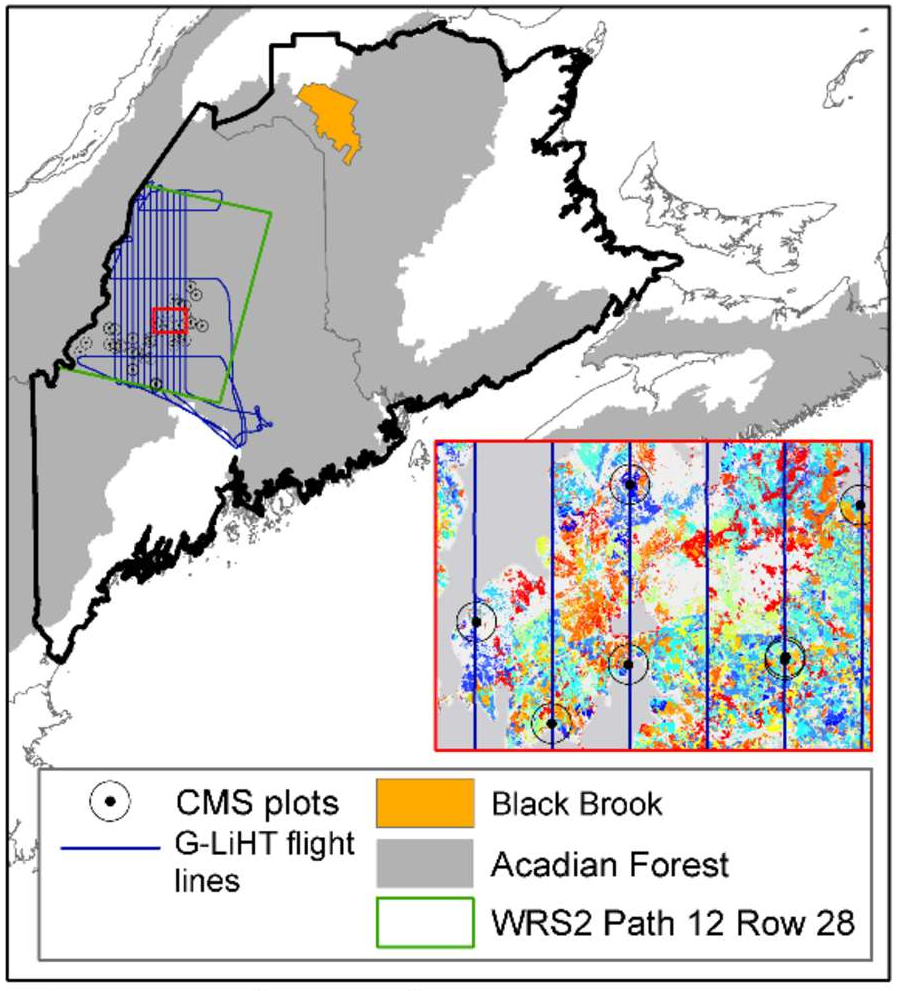
Orono, ME. Researchers from the University of Maine’s Center for Research on Sustainable Forests (CRSF) and School of Forest Resources (SFR) have been awarded funding from NASA for a 3-year, $940,308 research project to integrate remotely-sensed data along with forest inventory-based information into a forest landscape model framework that will be calibrated for application in the Acadian forest region of the northeastern USA and maritime Canada.
Managing forests to enhance carbon stores is a key strategy for mitigating future climate change, and has become an important policy goal at local, national and international levels. Management decisions depend on scientifically sound and reliable monitoring, reporting, and verification (MRV) systems for quantifying – and assessing the uncertainty in – stocks and transfers within and among the major forest carbon pools. However, regional and national estimates of forest carbon sinks differ significantly among assessments depending on the measurement or scaling approach used and the budget components considered.
the development of a robust, spatially-explicit, and dynamic MRV system.
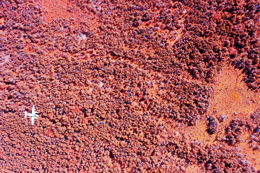
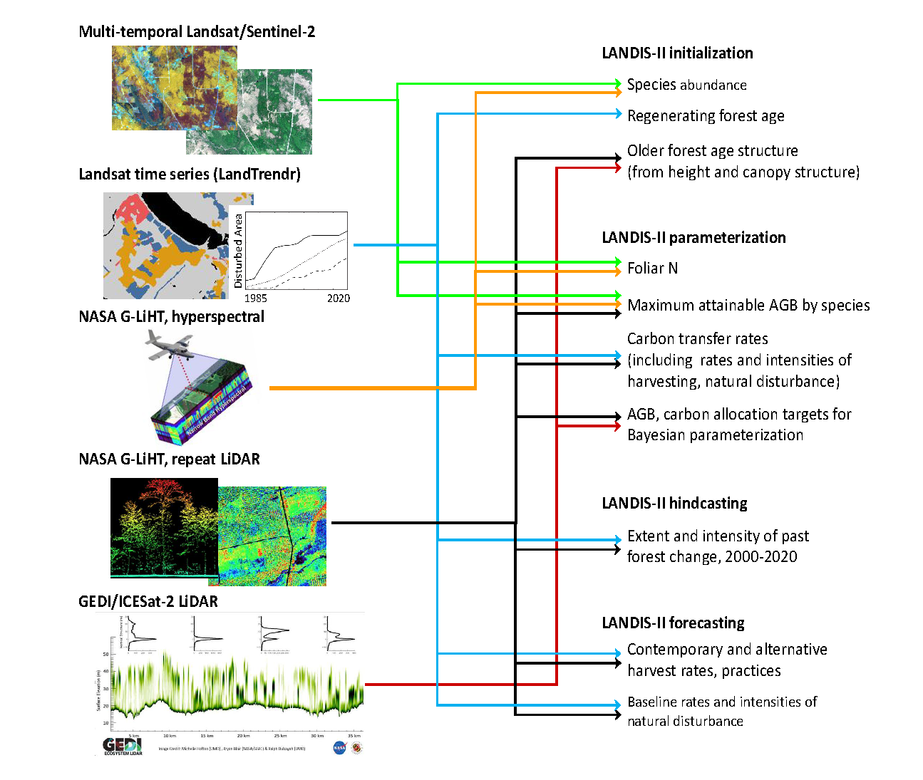
SFR associate professor and Wheatland Geospatial Lab director Daniel Hayes will lead the new project team along with CRSF director Aaron Weiskittel and SFR researchers Erin Simons-Legaard and Kasey Legaard. The UMaine investigator team will partner with colleagues in the US Forest Service, Canadian Forest Service and NASA’s Goddard Space Flight Center to develop an MRV system that tracks the stocks and fluxes among all of the major carbon pools in the managed forest sector. The model-data framework leverages several NASA assets and remote sensing sources, from the Landsat satellite image record to airborne light detection and ranging (LiDAR) acquisitions over the region.
Recently, UMaine’s CRSF completed the first ever state of Maine’s carbon budget using traditional inventory estimates, which only offer a coarse-resolution and static snapshot at certain points in time. However, because forests are highly dynamic over time and space, they require more frequent and detailed monitoring data. Using a multi-sensor and integrated approach, the researchers hope to provide a near real-time, high-resolution picture of forest carbon, while linking these estimates to projection models that can forecast future conditions across a range of alternative futures such as climate change, shifts in management activities, and potential disturbances like spruce budworm.
“This is an exciting project that allows us to bring our expertise in remote sensing and forest science to bear on the current state and possible future trajectory of the forest here in Maine, and across the broader region,” commented project PI Hayes. “This type of information has long been important for our scientific understanding of the regional-scale forest carbon cycle, and is becoming increasingly sought in greater detail by forestry practitioners for managing their forests to store carbon. We look forward to working with our forest industry and research collaborators to develop ways to tap into these remote sensing and modeling approaches to provide this information reliably and accurately.”
The project was funded under the NASA Carbon Monitoring System (CMS) Program. This is the first forest-based NASA CMS project in Maine and was one of 15 projects funded nationally. This effort links to other ongoing NASA forest-based efforts at the University of Maine including GEDI-FORCE and a healthy forest EPSCoR.
 For more information on the Wheatland Geospatial Laboratory, visit https://wheatlandlab.org
Contact: Daniel Hayes, daniel.j.hayes@maine.edu